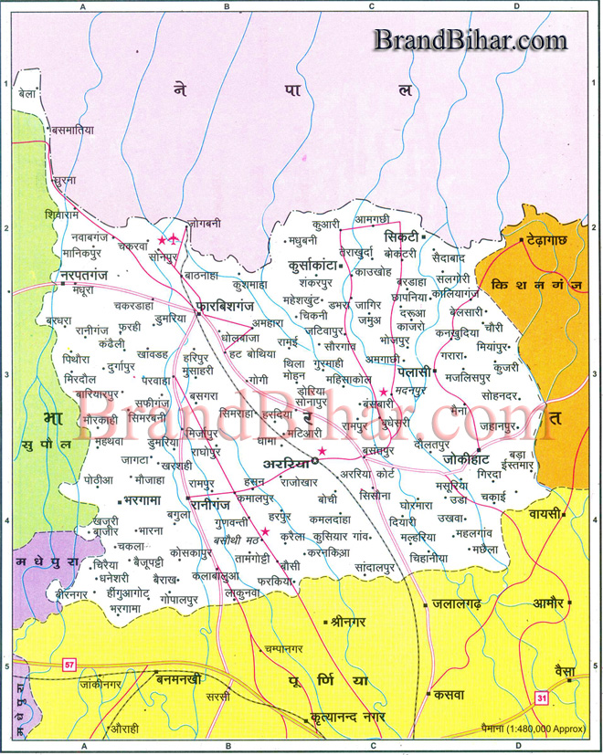
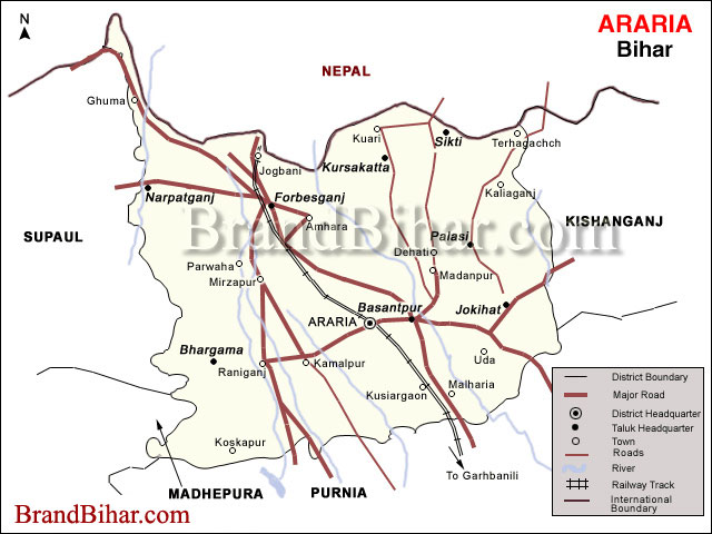
Map of Araria

Araria Araria is situated at the southern part of Purnia and Medhepura in Bihar. Borders of Araria are surrounded by Nepal in northern side, Kishanganj in western side and Supaul at south-eastern side. The district came into existence by division of Purnia district on Makar-Sankranti day of 1990. District border is adjacent to border of Nepal, so the district is important in terms of security. Jogbani is the last point of Araria and after that "Virat Nagar" district of Nepal starts. For transportation both train and road media's are available. Araria contains two bus terminals one at '0' mile and second in city. Buses for most of the districts are available and as well as for internal blocks too. Train facility is in the form of meter gauge track. This track ends one side to the Katihar, which is a big and important junction where from trains to all over India are available, other end of track is Jogbani the last point of Indian rail.
Click on the Map of Araria to see the largeView of Araria Map.
Nearest Railway Station : Araria court & Araria(R S) Distance from Purnia : 42 Km. Nearest Airport : Bagdogara Distance from Nepal : 42 Km. ADMINISTRATIVE DIVISIONS The state of Bihar, consisting of 24 districts, is divided into nine administrative divisions namely Patna, Purnia, Munger ,Bhagalpur , Koshi, Tirhut, Magadh, Saran, Rohtas. Purnia division is having 4 Districts, Araria District is divided into 9 talukas (administrative units ) and two sub-divisions as per details given below.
Sub- Divisions Blocks within the Sub-division Araria Araria, Kursakanta, Siktti, Raniganj, Jokihat, Palasi Forbesganj Forbesganj, Bhargama, Narpatganj
|