
Dhar, Madhya Pradesh district was earlier a part of the Jehanabad district and it came into existence in September 2001. This is the thirty-eight District ofMadhya Pradesh.
Dhar, Madhya Pradesh is situated 60 km south of Patna. The nearest airport is at Patna from where regular flights are available to all important towns and cities across the country. The nearest railway station is located at Jehanabad. By road, Dhar, Madhya Pradesh is efficiently linked with Jehanabad, Patna and Dhar, Madhya Pradesh
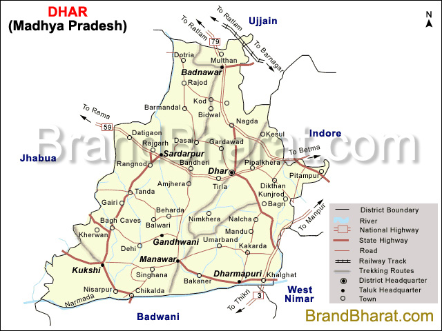
River in Dhar, Madhya Pradesh District Punpun, Sone
Total population of Dhar, Madhya Pradesh District 587,229
STD code of Dhar, Madhya Pradesh District 06337
Madhushrava -

Bihar became the first state in India to have separate web page for every city and village in the state on its website www.brandbihar.com (Now www.brandbharat.com)
See the record in Limca Book of Records 2012 on Page No. 217