
Bihar is located in the eastern region (Indo-Gangetic plain, North India) of India between latitude 24°-20'-10" N ~ 27°-31'-15" N and longitude 82°-19'-50" E ~ 88°-17'-40" E. It is an entirely land–locked state, in a Sub Tropical region of the Temperate zone. Area wise it is ranked 13 among the indian state. Total area of state is 94,163 km2 (36,357 sq mi).
Borders of Bihar State : North Side - Nepal, East Side - West Bengal, West Side - Uttar Pradesh and South Side - Jharkhand
Bihar is located in the eastern part of the country (between 83°-30' to 88°-00' longitude). It is an entirely land–locked state, although the outlet to the sea through the port of Kolkata is not far away. Bihar lies mid-way between the humid West Bengal in the east and the sub humid Uttar Pradesh in the west which provides it with a transitional position in respect of climate, economy and culture. It is bounded by Nepal in the north and by Jharkhand in the south. The Bihar plain is divided into two unequal halves by the river Ganga which flows through the middle from west to east.
Latitude of Bihar |
24°-20'-10" to 27°-31'-15" N |
|||
Longitude of Bihar |
83°-19'-50" to 88°-17'-40" E |
|||
Rural Area of Bihar |
92,257.51 sq. kms |
|||
Urban Area of Bihar |
1,095.49 sq. kms |
|||
Total Area of Bihar |
94,163.00 sq. kms |
|||
Height above Sea-Level of Bihar |
173 Feet |
|||
Normal Rainfall in Bihar |
1,205 mm |
|||
Avg. Number of Rainy Days in Bihar |
52.5 Days in a Year |
|||
Administrative Units |
||||
Divisions in Bihar |
9 |
|||
Districts in Bihar |
38 |
|||
Sub-Divisions in Bihar |
101 |
|||
CD Blocks in Bihar |
534 |
|||
Panchayats in Bihar |
8,463 |
|||
Number of Revenue Villages in Bihar |
45,103 |
|||
Number of Urban Agglomerations in Bihar |
9 |
|||
Number of Towns in Bihar |
130 |
|||
- Statutory Towns in Bihar |
125 |
|||
- Non-Statutory Towns in Bihar |
5 |
|||
Police Stations in Bihar |
853 |
|||
- Civil Police Stations in Bihar |
813 |
|||
- Railway Police Stations in Bihar |
40 |
|||
Police Districts in Bihar |
43 |
|||
- Civil Police District in Bihar |
39 |
|||
- Railway Police District in Bihar |
4 |
|||
Population of Bihar |
10,38,04,637 |
|||
| Rate of increase in Population | 25.07% | |||
- Male |
5,41,85,347 |
|||
- Female |
4,96,19,290 |
|||
Population (0~6 Years Group) |
18,582,229 |
|||
- In Absolute Numbers |
1,85,82,229 |
|||
|
||||
|
||||
- Percentage of Total Population |
17.6% |
|||
|
||||
|
||||
Literacy in Bihar |
|
|||
- In Absolute Numbers |
5,43,90,254 |
|||
|
||||
|
||||
- Percentage of Total Population |
63.82% |
|||
|
||||
|
||||
Decadal Population Growth (2001-2011) |
|
|||
- Absolute |
2,09,25,841 |
|||
- As Percentage |
25.07% |
|||
Highest Decadal Growth at |
|
|||
Lowest Decadal Growth at |
|
|||
- Civil Police Stations |
813 |
|||
- Railway Police Stations |
40 |
|||
Density of Population |
1,102 per sq kms |
|||
- Highest Density |
1882 per sq kms in Sheohar |
|||
- Lowest Density |
488 per sq kms in Kaimur |
|||
Sex Ratio (Females/Thousand Males) |
916 |
|||
- Highest Ratio |
1015 in Gopalganj |
|||
- Lowest Ratio |
879 in Bhagalpur and Munger |
|||
Highest Literacy Rate in Bihar |
75.59% in Rohtas |
|||
| Lowest Literacy Rate in Bihar | 52.49% in Purnia | |||
| Highest Female Literacy Rate in Bihar | 65.53% in Munger | |||
| Lowest Female Literacy Rate in Bihar | 42.73% in Saharsa | |||
| Highest Male Literacy Rate in Bihar | 85.29% in Rohtas | |||
Lowest Male Literacy Rate in Bihar |
60.99% in Katihar |
|||
Average Population of a District |
27,31,701 |
|||
Key Statistics - as per 2001 Census (Provisional) |
||||
Population of Bihar |
8,28,78,796 |
|||
- Male |
4,31,53,964 |
|||
- Female |
3,97,24,832 |
|||
Population (0~6 Years Group) |
||||
- In Absolute Numbers |
1,62,34,539 |
|||
|
||||
|
||||
- Percentage of Total Population |
19.59% |
|||
|
||||
|
||||
Literacy in Bihar |
||||
- In Absolute Numbers |
3,16,75,607 |
|||
|
||||
|
||||
- Percentage of Total Population |
47.53% |
|||
|
||||
|
||||
Decadal Population Growth (1991-2001) |
130 |
|||
- Absolute |
1,83,48,242 |
|||
- As Percentage |
28.43% |
|||
Highest Decadal Growth at |
Sheohar District (36.16%) |
|||
Lowest Decadal Growth at |
Nalanda District (18.64%) |
|||
- Civil Police Stations |
813 |
|||
- Railway Police Stations |
40 |
|||
Density of Population |
880 per sq kms |
|||
- Highest Density |
Patna, 1471 per sq kms |
|||
- Lowest Density |
Kaimur, 382 per sq kms |
|||
Sex Ratio (Females/Thousand Males) |
921 |
|||
- Highest Ratio |
(Siwan) 1,033 |
|||
- Lowest Ratio |
(Patna) 873 |
|||
Highest Literacy Rate in Bihar |
Patna, 63.82% |
|||
Lowest Literacy Rate in Bihar |
Kishanganj, 31.02% |
|||
Average Population of a District |
22,39,967 |
|||
Soil is one of the most important resources of a nation. It is the gift of nature of immense value. The most common use of the word soil is in the sense of a medium in which plants grow, although it has a different connotation at different time and place, and for persons engaged in different professions. Almost all the economic activities are directly or indirectly dependent on soil. Thus soil is the backbone of agricultural and industrial development.
Soil has a number of characteristics, which may be regarded as the aggregate of the physical, chemical and biological properties. The Bihar plane consists of a thick alluvial mantle of drift origin overlying in most part. The siwalik and older tertiary rocks. The soil is mainly young loam rejuvenated every year by constant deposition of silt, clay and sand brought by different streams. This soil is deficient in phosphoric acid, nitrogen and humus, but potash and lime are usually present in sufficient quantity.
There are three major types of soil in Bihar:
Piedmont Swamp Soil - found in northwestern part of west Champaran district.
Terai Soil – found in northern part of the state along the border of Nepal.
The Gangetic Alluvium – the plain of Bihar is covered by gangetic alluvium (both new as well as old).
The climate of Bihar is a part of the climatic pattern of the Indian subcontinent. It enjoys a continental monsoon type of climate owing to its great distance from the sea.
The factors affecting the climate of Bihar are:
It extends from 22-degree north to 27-degree latitude. Hence its location is tropical to sub tropical.
The Himalayan Mountains in the north have a significant bearing on the distribution of monsoon rainfall in Bihar.
Bihar joins the Ganga delta and Assam.
Seasons of Bihar and their duration:
Cold weather season - December to February.
Hot weather season – March to May.
Southwest monsoon – June to September.
Retreating southwest monsoon – October to November.
Bihar lies in the tropical to sub tropical region. Rainfall here is the most significant factor in determining the nature of vegetation. Bihar has a monsoon climate with an average annual rainfall of 1200 mm.
The sub Himalayan foothill of Someshwar and Dun ranges in Champaran constitute another belt of moist deciduous forests. These also consists of scrub, grass and reeds. Here the rainfall is above 1,600 mm and thus promotes luxuriant Sal forests in the favoured areas. The hot and dry summer gives the deduous forests. The most important trees are Shorea Robusta (Sal), Shisham, Cedrela Toona, Khair, and Semal. This type of forests also occurs in Saharasa and Purnia districts.
The topography of Bihar can be easily described as a fertile alluvial plain occupying the Gangetic Valley. The plain extends from the foothills of the Himalayas in the north to a few miles south of the river Ganges as it flows through the State from the west to the east. Rich farmland and lush orchards extend throughout the state. Following are the major crops: paddy, wheat, lentils, sugarcane, jute (hemp, related to the marijuana plant, but a source of tough fibers and "gunny bags"). Also, cane grows wild in the marshes of West Champaran. The principal fruits are: mangoes, banana, jack fruit and litchis. This is one the very few areas outside China which produces litchi.
Water like ground and mineral resources is of great significance as it provides means of drinking water for man and animals, irrigation for agriculture, industrial uses, production of hydro-electricity, transportation and recreation etc. The importance of water is so immense that the people in ancient times worshipped it.
Bihar is richly endowed with water resources, both the ground water resource and the surface water resource. Not only by rainfall but it has considerable water supply from the rivers which flow within the territory of the State. Ganga is the main river which is joined by tributaries with their sources in the Himalayas. Some of them are Saryu (Ghaghra), Gandak, Budhi Gandak, Bagmati, Kamla-Balan and Mahananda.
There are some other rivers that start from the platue area and meet in Ganges or its associate rivers after flowing towards north. Some of them are Sone, Uttari Koyal, Punpun, Panchane and Karmnasha.
There are several rivers in Bihar which contribute a lot to the peoples of Bihar. These rivers make the water available for irrigation purpose and also help in generating the hydro-thermal energy for the state. Apart from this they provide a medium for water transport, provide fishes for fishery industry and enrich the natural resources of state in many other ways.
All the above rivers have their impact on the Bihar plain. State also has non-exhaustible source of ground water which is in use for drinking purposes, irrigation and industries.
Steatite - 945 Tonnes
Pyrites - 9,539 Tonnes
Quartzite - 14,865 Tonnes
Crude Mica - 53 Tonnes
Limestone - 4,78,000 Tonnes
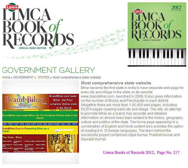
Bihar became the first state in India to have separate web page for every city and village in the state on its website www.brandbihar.com (Now www.brandbharat.com)
See the record in Limca Book of Records 2012 on Page No. 217