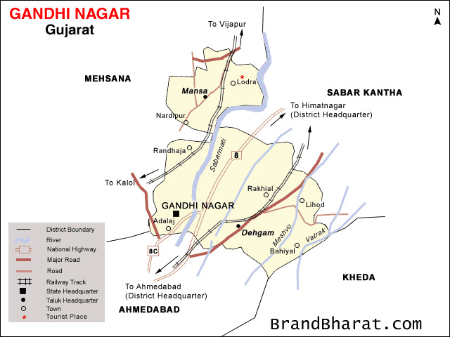

Gandhinagar district is an administrative division of Gujarat, India, whose headquarters are at Gandhinagar, the state capital. It was organized in 1964.
It has an area of 649 km², and a population of 1,334,455 of which 35.02% were urban (2001 census). The district includes Gandhinagar with three Suburbs - Chandkheda, Motera, Adalaj. The four tehsils are - Gandhinagar, Kalol INA, Dahegam and Mansa - and 216 villages.
Gandhinagar district is bounded by the districts of Sabarkantha and Aravalli to the northeast, Kheda to the southeast, Ahmedabad to the southwest, and Mehsana to the northwest.
Connected to Ahmedabad by the Sarkhej-Gandhinagar highway, and with Vadodara with the Ahmedabad-Vadodara highway, these three cities form the top population centres and commercial heart of Gujarat and western India.
Gandhinagar city is a well planned city like Chandigarh (State Capital of Haryana & Punjab, India) which is having 30 sectors which are of 1 km each in Length and Width. Each sector has a primary school, a secondary school, a higher secondary school, a medical dispensary, a shopping centre and a maintenance office.
Akshardham Gandhinagar is situated in Sector-20. It is one of the major Hindu Temple complex of Gujarat.


Bihar became the first state in India to have separate web page for every city and village in the state on its website www.brandbihar.com (Now www.brandbharat.com)
See the record in Limca Book of Records 2012 on Page No. 217