
Meghalaya means "the abode of clouds" in Sanskrit. Tucked away in the hills of eastern sub-Himalayas is Meghalaya, one of the most beautiful State in the country. Nature has blessed her with abundant rainfall, sun-shine, virgin forests, high plateaus, tumbling waterfalls, crystal clear rivers, meandering streamlets and above all with sturdy, intelligent and hospitable people. The state is the wettest region of India, bounded to the south by the districts of greater Mymensingh and the Division of Sylhet and the west by the Division of Rangpur of the People's Republic of Bangladesh and the north and the east by India's Assam state. The capital is Shillong, known as the "Scotland of the East".
The detail analysis of Population Census 2011 published by Govt. of India for Meghalaya state reveal that population of Meghalaya has increased by 27.95% in this decade compared (2001-2011) to past decade (1991-2001). The density of Meghalaya state in the current decade is 343 per sq mile.
Meghalaya is an State of India with population of Approximate 29.67 Lakhs.
The population of Meghalaya state is 2,966,889.
The density of Meghalaya state is 132 per sq km.
Meghalaya State is spread over 22,429 Sq Km.
Language - Khasi, Pnar, Garo & English
Meghalaya was previously part of Assam. Emergence of Meghalaya as an Autonomous State on 2nd April 1970 and as a full-fledged State on 21st January 1972 marked the beginning of a new era of the geo-political history of North Eastern India. It also marked the triumph of peaceful democratic negotiations, mutual understanding and victory over violence and intrigue.
The State of Meghalaya is situated on the north east of India. It extends for about 300 kilometres in length and about 100 kilometres in breadth. It is bounded on the north by Goalpara, Kamrup and Nowgong districts, on the east by Karbi Anglong and North Cachar Hills districts, all of Assam, and on the south and west by Bangladesh.
Shillong, the capital of Meghalaya is located at an altitude of 1496 metres above sea level. Shillong, which was made Assam's capital in 1874, remained so till January 1972, following the formation of Meghalaya. The capital city derives its name from the manifestation of the creator called Shyllong.
Meghalaya is subject to vagaries of the monsoon. The climate varies with altitude. The climate of Khasi and Jaintia Hills is uniquely pleasant and bracing. It is neither too warm in summer nor too cold in winter, but over the plains of Garo Hills, the climate is warm and humid, except in winter. The Meghalayan sky seldom remains free of clouds. The average annual rainfall is about 2600 mm over western Meghalaya, between 2500 to 3000 mm over northern Meghalaya and about 4000 mm over south-eastern Meghalaya. There is a great variation of rainfall over central and southern Meghalaya. At Sohra (Cherrapunjee), the average annual rainfall is as high as 12000 millimetres, but Shillong located at a distance of about fifty kilometres from Sohra receives an average of 2200 mm of rainfall annually.
Transport
There are four National Highways NH 40, NH 44, NH 51, NH 62 in the State having a total length of 706.56 km. The public transport services have a sufficiently wide coverage linking the important places within the State and with places in neighbouring states.
The road length at the time of creation of Meghalaya in 1970 was only 2786.68 km only which has gone upto 7633.00 Km by 31st March 2003 and the road density increased from 12.35 km per 100 square kilometer to 7633 kms; out of which 3691 km is black topped and remaining 3942 km is graveled. The road density has increased to 34.03 km per 100 square.
Guwahati (103 km from Shillong) is the nearest railway station connecting the North-East region with the rest of the country through a broad gauge track network. There is a plan for extending the rail link from Guwahati to Byrnihat (20 km From Guwahati) within Meghalaya.
Umroi (35 km from Shillong) is the only airport in Meghalaya having landing facility for smaller aircrafts and is having flight connected with Kolkata, Aizawl and Silchar. Another small airport is planned near Tura. Borjhar, the most important airport in the North-Eastern Sector have facility for bigger jet aircrafts (like Boeing and Airbus) is 124 km from Shillong. There is also a helicopter service connecting Shillong to Guwahati and Tura.
Festivals of Meghalaya
Khasis
Dance is at the very heart of Khasi life, rich in repertoire, performed often as a part of the "rites de passage"- the life-cycle of an individual in society or the annual passage of the seasons. Dances are performed at the level of individual villages (Shnong), a group of villages (Raid) and a conglomeration of Raids (Hima). Local or regional flavours and colours bring variations to the basic dance form, which is universal in Khasi folk culture. Different types of Festivals are :-
Ka Shad Suk Mynsiem.
Ka Pom-Blang Nongkrem
Ka-Shad Shyngwiang-Thangiap
Ka-Shad-Kynjoh Khaskain
Ka Bam Khana Shnong
Umsan Nongkharai
Shad Beh Sier
Jaintias
Festivals of the Jaintia Hills, like others, contribute significantly to maintaining a balance between man, his culture and his natural environment or eco-system. At the same time it seeks to revive the spirit of cohesiveness and solidarity among the people. Festivals of Jaintias can be broadly studied under the following names :-
Behdienkhlam
Laho Dance
Sowing Ritual Ceremony
Garos
The main festivals of Garos are Den Bilsia, Wangala, Rongchu gala, Mi Amua, Mangona, Grengdik BaA, Jamang Sia, Ja Megapa, Sa Sat Ra Chaka, Ajeaor Ahaoea, Dore Rata Dance, Chambil Mesara, Do'KruSua, Saram Cha'A, A Se Mania or Tata.
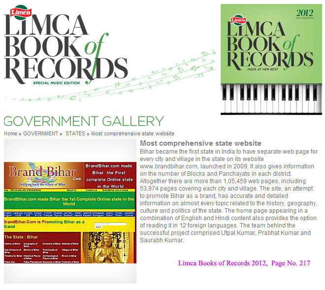
Bihar became the first state in India to have separate web page for every city and village in the state on its website www.brandbihar.com (Now www.brandbharat.com)
See the record in Limca Book of Records 2012 on Page No. 217