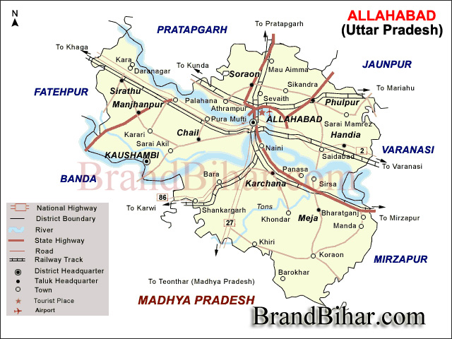

Allahabad is located at 25.45°N 81.84°E in the southern part of the Uttar Pradesh at an elevation of 98 meters (322 ft) and stands at the confluence of two, the Ganges and Yamuna. The region was known in antiquity as the Vats country. To its south and southeast is the Bagelkhand region,To its east is middle Ganges valley of North India, or Purvanchal,To its southwest is the Bundelkhand region, to its north and northeast is the Awadh region and to its west along with Kaushambi it forms the part of Doab i.e the Lower Doab region.
In the North district Pratapgarh, in the south Rewa (M.P.), in the east Sant Ravi Das Nagar and in the west kaushambhi districts are located.
Geographical Area of Allahabad - 5482 Sq. Km.
Population in Allahabad - 4936000
Literacy in Allahabad - 62.89
Tehsils in Allahabad - 8
Development Blocks in Allahabad - 20
Nyay Panchayat in Allahabad - 218
Gram Sabha in Allahabad - 1425
Populated Villages in Allahabad - 2802
Nonin Allahabad -Populated Villages in Allahabad - 1262
Towns in Allahabad - 13
Bus Station / Bus Stop in Allahabad - 241
Railway Station in Allahabad - 35
Rural Post Office in Allahabad - 75
Urban Post Office in Allahabad - 334
Telegraph Office in Allahabad - 5
Branches of Nationalised Banks in Allahabad - 195
Branch of Rural Banks in Allahabad - 73
Branch of Cooperative Banks in Allahabad - 34
Temperature (Maxi) in Allahabad - 45.5
Temperature (Mini) in Allahabad - 03.5
Primary School in Allahabad - 3228
Junior High School in Allahabad - 1854
Higher Secondary School in Allahabad - 767
Degree College in Allahabad - 84
Industrial Training Institute (I.T.I) in Allahabad - 3
Allopathic Hospital & Dispensary in Allahabad - 69
Ayurvedic Hospital & Dispensary in Allahabad - 34
Homeopathic Hospital & Dispensary in Allahabad - 34
Egyptian in Allahabad - 4
River in Allahabad, Uttar Pradesh District - Ganga, Yamuna and mythical Sarasvati

The district is divided into eight TEHSILS named as Sadar, Karchhana, Phulpur, Bara, Koraon, Meja, Soraon and Handia. Tehsils are divided into Development Blocks.There are twenty development blocks. Kaudihaar, Holagarh, Mauaima, Soraon are the development blocks in the Soraon tehsil, Bahria, Phulpur, Bahadurpur are the development blocks in the Phulpur Tehsil, Pratappur, Saidabad, Dhanupur, Handia are the development blocks in the Handia tehsil, Jasra, Shankargarh are the development block of Bara tehsil, Chaka, Karchhana, kaundhiyara are the development block in the Karchhana Tehsil, Uruwa, Meja, Manda are the development block in the Meja tehsil and Koraon is the development block in the Koraon tehsil.
Allahabad features the typical version of a humid subtropical climate that is common to cities in north-central India. Allahabad experiences three seasons: hot dry summer, cool dry winter and warm humid monsoon. The summer season lasts from April to June with the maximum temperatures ranging from 40 °C (104 °F) to 45 °C (113 °F). Monsoon begins in early July and lasts till September. The winter season lasts from December to February.
The Ganga and The Yamuna are the main rivers of the district.The plain area of the district is situated in between Ganga and Yamuna so these rivers plays a very pivotal role in the agriculture of the district.
The District Allahabad is mainly a agricultural district in which the main crops are wheat and rice Some area is cultivated under pulses also like Arhar, Urad and Chana. he principal sources of irrigation are canals and tubewells.
Located approximately 7 km from Civil Lines, it is actually the confluence of three holy rivers-Ganga, Yamuna, and Saraswati. It becomes a center of attraction for hundreds and thousands of religious travelers after every twelve years when it hosts the famous Kumbh Mela. It stands as one of the greatest tourist attractions on your tour to India.
Built by Akbar in AD 1583, the Allahabad Fort exhibits fine depictions of art, design, architecture, and craftsmanship of the fort. Visitors are allowed to view the Ashoka Pillar, Saraswati Kup and Jodhabai Palace.
Located inside the Allahabad Fort, this is actually an underground temple, alluding to associations with Lord Rama. The famous Akshaya Vat one of the most revered trees of the Hindus is also sited within the temple.
The ancestral home of the Nehrus, the Anand Bhawan now houses a memorabilia of the Nehru-Gandhi family and one of the excellent museums of India.
Located next to the Anand Bhawan, and built by Pt. Moti Lal Nehru, it is the house where the former Prime Minister of India Mrs. Indira Gandhi was born.
This huge garden houses the mausoleums of Khusrau, his sister, and his Rajput mother.
Located near the Allahabad Fort, it is famous for the image of the reclined position monkey-god Hanuman.
Situated near Chandra Shekhar Azad Park, the Allahabad Museum preserves the paintings of Nicholas Roerich, terracotta figurines, Rajasthani miniatures, coins and stone sculptures from the 2nd century BC till date.
Allahabad is an important pilgrimage destination in the Ganges plain and that is why it is well connected to all the major cities in Uttar Pradesh and India. The Kumbh Mela that takes place on its confluence is attended by millions of Hindus round the globe.
There is an Airport at Bamrauli which is near about 10 Kilometers away from Allahabad. Presently limited flights are available here. The second nearest Airport is at Varanasi that is 150 kilometers from Allahabad. Varanasi being another important pilgrimage is well connected to the rest of India by daily flights. Both private as well as public carriers operate these flights.
Allahabad is well connected by trains with all major cities, viz. Calcutta, Delhi, Jaipur, Lucknow and Mumbai. The main station in Allahabad is Allahabad Junction. Several expresses as well as super fast trains ply to and from Allahabad.
Allahabad, on National Highways 2 and 27, is connected to all parts of the country by good roads. Buses ply to all the neighboring as well as far-flung places such as Varanasi, Lucknow, Kanpur, Patna, Jhansi and Gorakhpur among others. Both Uttar Pradesh State Road Transport Corporation as well as Private players operates these buses.

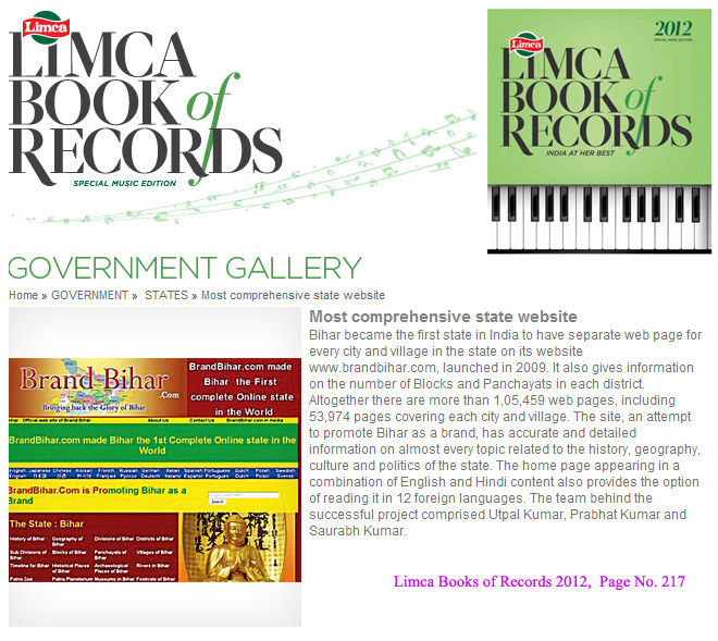
Bihar became the first state in India to have separate web page for every city and village in the state on its website www.brandbihar.com (Now www.brandbharat.com)
See the record in Limca Book of Records 2012 on Page No. 217