
District Amethi lies at the latitude 26°9’ north and longitude 81°49’ east at an average elevation of 101 metres(331 feet) from mean sea level. The total geographic area of the districts is about 3063 km2. The surface is generally level, being broken only by ravines in the neighbourhood of the rivers. The principal river is Gomti,which passes through the centre of the district. North side of this district is bounded by Faizabad District; South side is bounded by Pratapgarh District. West side is bounded by Bara-Banki District and Rai Baeilly District and the East side is bounded by Amethi District.
Amethi district is the 72nd district of the state of Uttar Pradesh. This district is part of Faizabad division. It covers an area of 3,070 km. Gauriganj is the administrative headquarters of the district. Amethi was recently changed to district and officially named after Chhatrapati Shahuji Maharaj by B.S.P. Govt., and is 72nd district in the state of Uttar. Recently the name Chatrapati Shahuji Maharaj Nagar changed back to Amethi as SP govt. came in the power in year 2012. Amethi lies in latitude 26 degree 9 minute north and longitude 81 degree 49 minute east on Raebareli-Amethi-Sultanpur road about 40 km south-west of Sultanpur. Also called as Raipur-Amethi, of which Raipur belonged to the Raja of Amethi who lived at Ram Nagar. His ancestors used to reside in Raipur-Phulwari where the old fort is still found. Here is also a temple called Hanumangarhi and a mosque both built about hundred years ago. About three kilometres north of Ram Nagar there is a tomb of famous poet, Saint Malik Muhammad Jayasi where he died, and the fort was built by Bachghoti Rajas.
The land of Amethi district is generally plane except some regions around the Gomti River which drains almost the whole district. It may be called an agrarian area as agriculture is the main occupation of the people. Amethi district has a wet and dry climate with average temperatures ranging between 23 °C to 28 °C. Amethi experiences three distinct seasons: summer, monsoon and a mild autumn. Typical summer months are from March to May,with maximum temperatures ranging from 36° to 44 °C. The rainy season in the districts falls between June and September and July being the wettest month of the year. Winter starts from November. The daytime temperature hovers around 22 °C while night temperature is below 8 °C during December and January, often dropping to 2°to 3 °C.
Amethi is connected to the major cities in Uttar Pradesh and North-Eastern India via Indian Railways and roads. It has direct trains connecting with major cities like Delhi, Lucknow, Kanpur, Dehradun, Haridwar, Allahabad, Varanasi, Kolkata, Puri, Bhopal, Mumbai and Bangalore. A number of Uttar Pradesh State Road Transport Corporation buses ply from Amethi.
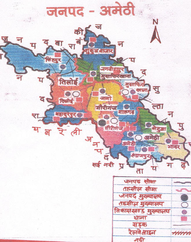
The district comprises 4 tehsils, 13 development blocks, 14 police stations and 401 lekhpal areas. These tehsils are: Gauriganj, Amethi, Musafirkhana and Tiloi. Amethi is the largest city in this district.
The district comprises 5 Vidhan Sabha constituencies, namely, Gauriganj, Jagdishpur, Amethi, Tiloi and Salon. All of these are part of Amethi Lok Sabha constituency.
The district is surrounded by the constituency districts of Faizabad, Barabanki

Bihar became the first state in India to have separate web page for every city and village in the state on its website www.brandbihar.com (Now www.brandbharat.com)
See the record in Limca Book of Records 2012 on Page No. 217