
Hapur (Haripur) is located at 28.72°N 77.78°E. It has an average elevation of 213 meters (699 feet). It is bound on the north by Meerut, in the south by Bulandshahr while Ghaziabad form the southern and western limits. Jyotiba phule nagar district lies to the east of the district. The river Ganges forms the eastern boundary and home to the sacred place known as 'Garhmukteshwar' where lakhs of people come every year for pilgrimage. The ground is not rocky and there are no mountains. The soil is composed of pleistocene and sub-recent alluvial sediments transported and deposited by river action from the Himalayan region. These alluvial deposits are unconsolidated. Lithologically, sediments consist of clay, silt and fine to coarse sand. Land is very fertile for growing crops, especially wheat, sugarcane and vegetables. Also, the river 'kali nadi' passes from the outskirts of the city.
PIN and STD Code of Hapur, Uttar Pradesh
PIN (Postal Index Number) of Hapur is 245101. The STD code is 0122.The RTO NO:- UP-37
Wards in Hapur
There are 36 wards in Hapur. Major colonies of Hapur are:-
Feasting and Fasting are the special features of Hindu festivals which are celebrated here almost in the same manner as else where in the State. The important ones being described below :
Ram Navami falls on the ninth day of the bright half of the Chaitra to celebrate the birthday of Lord Rama. People fast on this day and the temples of Lord Rama are decorated & illuminated at night. The Ramayana is read in the temples and in the homes of many Hindus, large numbers of devotees flock to listen to the recitations.
Naga Panchami is celebrated on the fifth day of bright half of the Sravana to propitiate nagas or serpent gods. This is a big rainy season festival and women & girls sing songs. During these days swinging is very popular. Drawings of snakes are made on the walls of houses and are worshipped with milk, rice and flowers are offered to them.
Janamastmi falls on the eight day of the dark half of the Bhadra to commemorate the birthday of Lord Krishna. People fast throughout the day and break their fast with the eating of prasad which is distributed at midnight after the anniversary of the birth of Lord Krishna is celebrated.
There is a temple of Dudheshwar Nath in this place about which a story goes that more than 250 years ago a Brahmana happened to pass by the site and saw a cow digging a hole in the earth into which she let her milk flow. Impressed by this the Hindus built a temple here and dedicated it to the Dudheshwar Nath, which attracts about fifty thousand persons on the occasion of Janmastmi.
Dasahra falls on the tenth of the bright half of the Asvina and is celebrated with the great enthusiasm in the district. It commemorates the victory of Rama over Ravana. Ramlila celebrations are held at different place in the district and a big fair is held in the city of Ghaziaabad at Ramlila ground near ghantaghar.
Dipavali , the festival of lights, falls on the last day of the dark half of Kartika. Festivities start two days earlier with Dhanteras when metals utensils are purchasedas a token of prosperity. The next day, Narak Chaturdashi, a few small earthen lamps(diyas) are lit as a preliminary to the main day of the festival when every Hindu house in the districts illuminated and the goddess laxmi is worshipped. Businessman and Trades close their account on this day and start their new year and pray for prosperity in it. There is no fasting on this occasion as Divali is regarded as a festival of feasting.
Shivratri is celebrated in honor of the birth of Lord Shiva and falls on the thirteen day of the dark half of Phalguna. A fast is observed during the day and a vigil is kept at night when the god is worshipped. The temples of Shiva are specially decorated and devotees offer water and flowers.
Holi is the last major festival of the Hindu calendar and it falls on the full-moon day of Phalguna. In the villages people start the singing of phages during the nights, long before the actual day of the festival. Five or six days before the festival people start piling up firewood and bonfires are lit on the night of the festival itself. Ears of barley and wheat are also roasted in these fires. On the following day there is a common rejoicing water takes the form of people throwing colored powder and colored water on one another and paying visits to relations and friends.
The important festivals observed here by the Muslims are Barawfat, Shab-e-Barat, Id-ul-Fitr and Muharram which is an occasion for mourning rather than a festivals.
The main festivals of the Christians are Christmas which falls on 25th Dec.; Good Friday.
The important festivals of the Sikhs are the birthday of their gurus, Nanak and Govind Singh, Lorhi and Baishaki.
A big bathing festival is observed on Kartikipurnima, the full moon day in the month of Kartika. People take a bath a bath in the Ganga and a big fair is held at Garhmukteshwar on this occasion which is attended by about six lakhs of persons.
Standing on a high cliff on the right bank of the Ganga a short distance from its junction with the Burhganga, the town lies in Lat. 280 47' North and Long. 780 6' East, 65 kms. east of the district head quarter and 32 kms east of Hapur. About 2 kms west of the town the metalled road coming from Meerut meets the national highway which comes from Delhi via Hapur (and goes on to Moradabad crossing the Ganga at Garhmukteshwar by means of the bridge built in 1961). There is a railway station at Garhmukteshwar on the Delhi-Moradabad line of the Northern Railway.
Garhmukteshwar is aplace of hoary antiquity, mention being made of it in the Bhagvat Purana and the Mahabharata. It is said that it was a part of the ancient city of Hastinapur (the capital of the Kauravas). There was an ancient fort here which was repaired by a Maratha leader named Mir Bhawan and was in so good a condition when the british took possession of the place that it was found possible to locate the tahsil in it without incurring much expence on alteration. The name of the place is derived from the great temple of Mukteshwar Mahadeva, dedicated to the goddess Ganga who is worshipped here in four temples, two suitated on a high cliff and two blow it. The one close to the Meerut road has a well , the water of which is belived to be so sacred as to cleanse the since of those who bathe with it; near it are eighty sati pillars, marking the spots where Hindu widows are said to have become sati. There is in the town a mosque buikt by Ghayas-ud-din Balban bearing an inscription in Arabic with the date 682 Hijri (1283 A.D.).
The place has considerable religious importance of the Hindus, a bathing fair being held here on the full-moon day of Kartika when about six lakh persons, from far and near , come to have a dip in the river Ganga which they consider to be holy. Another fair, held (in Jyaistha) on the ocassion of Dasahra, attracts about one 50,000 persons.
On 26th January 1977, Garhmukteshwar becomes tahsil under district Ghaziabad and on 11th September 1979 Ghaziabad Zila Parishad constituted. Till then this historical Garh Ganga Fair is continousely sponsered by Zila Parishad.
At the time of Fair the entire region becomes a city of tents. It facinate a lot the people in the light of moon.
Gadho-ka-Mela is also a part of this big Garh Ganga fair, in which about 50,000 Ass/ Donkey/ Horse are purchase and sold out. The business man from all over the country even neighbouring countries like Pakistan and Bangladesh also take part in this Gadho-ka-Mela.
Ajrara (Tahsil Hapur)
This village lies on the left bank of the Kali Nadi in Lat. 280 50' North and Long. 770 49' East, about 13 Kms north of Hapur and 7 Kms east of Kharkhauda which is both a Govt. Roadways Bus Station (on the Meerut-Hapur route) and a Railway Station (on the Meerut-Khurja line).
The place is said to have been the seat of Hindu monarchy before the advent of the Muslims. The name owes its origin to a Yogi named Ajaipal who built a thakurdwara (temple) here and called it Ajaipara, the present name Ajrarabeing its corrupt form. Khwaja Basant Khan, who got the village in Jagir in the time of Muhammad Shah, built a fort here which was razed to the ground by the Marathas in 1794 when Fateh Ali Khan rebelled.
Bahadurgarh (Tahsil Garh)
The village of Bahadurgarh lies in Lat. 280 40' North and Long. 780 7' East, in the south-eastern corner of the district, 78 Kms from Ghaziabad and 48 Kms from Hapur. From Wahabpur Thera, a village on the Garhmukteshwar-Bulandshahr road, a kutcha road about 3 kms long leads to this village.
The village was originally known as Garh Nana and was bestowed bu Jahangir upon Nawab Bahadur Khan, a Pathan, who changed the name to Bahadurgarh. About 6.5 kms north to this place(near Mustafabad) there are the ruins of a village known as Raja Karan-ka-Khera which is set to have been founded by Raja Karna (of Mahabharata fame).
The village was the original home of what has come to be known as Khurja pottery-an industry that was introduced here from Multan about 250 years ago. It is also known locally for its handloom cloth. The products of the government dairy located here find a ready market in Delhi.
Dasna (Tahsil Ghaziabad)
This, the headquarters of the pargana, is situated in Lat. 280 41' North and Long. 770 32' East, to the east of the Hapur road at a distance 10 kms from Ghziabad and 24 kms west of Hapur. The place gives its name to a railway station on the Ghaziabad-Moradabad branch line of the Northern Railway, the railway station actually lying within the limits of the adjoining village of Masuri.
Dasna owes its origin to Salarsi, a Rajput raja of Mahmud Ghajnavi's days. It is said that the raja had gone to bathe in the Ganga in order to get rid of his leprosy and, liking the place, settled down in it and also built a large fort there. While digging the foundation of the fort, a man is stated to have been fatally bitten by a snake, an incident which is said to have given the place its name, "DASNA", meaning to bite (used only for the bite of a snake). The village was ravaged by Ahmad Shah Abdali in 1760 when he pulled down the fort.
Dhaulana (Tahsil Ghaziabad)
The village lies on the road which takes off at Dasna and joins the Meerut-Hapur-Bulandshahr road at Gulaothi and is 25 kms from tahsil headquarters. It is connected in the north with the Pilkhuwa railway station by a 8 kms kutcha road. According to a local account, the village was founded by a man named Dhaul Singh about 1500 years ago and was named after him. It was sacked by the Sikhs in 1780 and again became the scene of action during the freedom struggle of 1857 in which the local Rajputs took a leading part, 14 of them being said to have been hanged. In 1957 the villagers raised a memorial in honor of these martyrs.
In a village there is a temple of Sati Malindi Devi, near which a fair is held. It is said that the villagers used to perform their worship in the village of Nagla Kashi but after a fight between the people of the two villages about a hundred years ago, those of Dhaulana built a temple in their village, which is still in existence.
Hapur (Pargana and tahsil Hapur)
the headquarter of the tahsil, lies in Lat. 280 44' North and Long. 770 47' East, 34 kms east of Ghaziabad. Hapur is a railway junction where the Delhi-Moradabad and the Meerut-Khurja lines of the Northern Railway meet.
It is said that the place was founded about 983 A.D. by Haradatta, the Dor chieftain of Bulandshahr and Meerut, and was named haripur after him. Another derivation is from the word 'hapar' ,which signifies an orchard. A system of grants for the disabled and retired personnel of the army was introduced here by Perron (a French Military commander) and was adopted by the British for many years under which wastelands were cleared of jungles and were assigned to invalid pensioners. Ibrahim Ali, the tahsildar of Hapur, defended the town against Amir Khan Pindari and his 500 men in 1805. The forces of Walidad Khanof Malagarh planned an attack on the town during the struggle for freedom in 1857 but in was foiled by the Jats of Bhatona.
Hapur is a leading grain and jaggery market of the country and is well known for its papar (savoury comestible something like a large wafer). Brass utensils and handloom cloth manufactured here enjoy a local reputation. A market is held on Mondays in which the main commodities of sale are ghee and earthen pots.
Formerly, there were in the town five gates known as the Delhi, Meerut, Garhmukteshwar, Kothi and Sikandra, but no vestiges of their existence are to be found apart from the localities of their names. The Jama Masjid (built during the reign of Aurangzeb in 1670) is the chief ornament of the town.
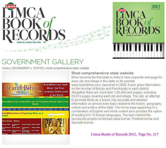
Bihar became the first state in India to have separate web page for every city and village in the state on its website www.brandbihar.com (Now www.brandbharat.com)
See the record in Limca Book of Records 2012 on Page No. 217