
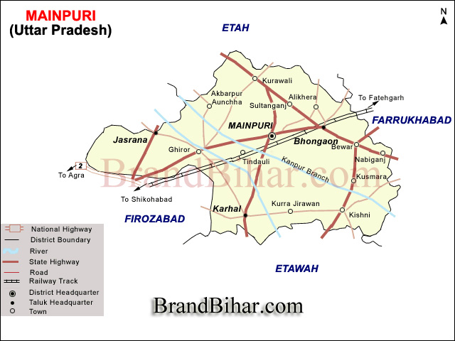
Mainpuri is a District of Agra Division, Uttar Pradesh, India, is bounded on the North by Etah District, on the East by District Farrukkhabad and Kannauj, on the South by District Etawah and on West by the District Firozabad and Etah. It lies between North Latitude 260 53' to 270 31' and East Logitude 780 27' to 790 26'. The area of the district is 2745 sq. k.m. and population is 13,11,492 in 1991.
Topography : The district generally presents the appearance of an extensive level plain broken only by the sand ridges on the western border, the rolling sand hills and undulations of the Kali and Isan rivers, and the ravines along the Yamuna to the south-west. The Kali Nadi forms the boundary of this plain on the north and north-east and the Yamuna encloses it on the south-west. Both these rivers flow towards the south-east, and between them, in almost parallel courses, run the four smaller streams, the Isan , The Arind, The Sengar, and the Sirsa, following the general slope of the country from north-west to south-east. Taking the district from north to south , the average fall of the rivers, excluding the Yamuna, in 1.5 feet per mile, and the average slope of the surface of the country is 1.2 feet per mile. A line of levels taken across the district from the Yamuna to Kali shows that the watershed of the streams running through it at the point of intersection are almost exactly the same height above the level of the sea. The highest point in the district is only 139 feet above the lowest.
Level : are extremely important in canal distrct like Mainpuri and are constantly referred to by the canal enginners; who have their own private bench-marks;generally the mile stones along the main canal. The main bench-marks are thegrand trigonometrieal survey bench- marks the one at the Ghiror at the corner of the Ghiror canal inspection house in the Etawah canal division is marked 527.29 above the sea,and on the top of the north-western wall of the ghiror canal bridge is another such mark showing 534.23feet. in the Baragaon village in Mustafabad pargana is a third, showing 573.3feet. at Mainpuri opposite the entrance of the gail two paces in side boundary is a fourth with 511 feet. In the Mainpuri canal division, Bewar branch,the bridges are used as bench-marks as arule. The only grand trigonometrieal survey marks in this division is one at Singhpur on the etawah road with 517.83 feet, situated near the south-east corner of the canal chauki. There are no grand trigonometrieal survey bench-marks on the Bhognipuri or Aligarh branches, and only one in the Cawnpore division, at Ramnagar, two paces from the south-east corner of the Tarha canal Chauki on the Cawnpore branch; height 494.31 feet. The east Indian railway has bench-marks at railway stations on the Farrukhabad branch with reduced leveles as follows:-- Shikohabad, on the well south of theline 1,300 feet from the center of the Shikohabad station towards Farrukhabad,532.65; araon, on pillar 200 feet north of the line 100feet on the Shikohabad side of 1st span of 6 feet grider at the Shikohabad end of the station yard,518.16; araon, on parapet of eulvert at the Farrukhabad end of the station, 523.01; Kosma,center of station,80 feet south,517.41; Mainpuri,on boundary pillar to the north at the center of the station,510.92; Mainpuri, on furlong post no 2to the south, 300 feet on the Shikohabad side of the bridge of 2spans of 28 feet over the Sathni Dalippur drain,510.64; Bhongaon, ston no.8 to the south at the Farrukhabad end of the station yard, 506.62; mota,no,7 mile post to the north,100 feet beyond the girder of one span of 12 feet, 700 feet beyond the Farrukhabad end of the station yard,504.52.
Soil : Generally speaking the soils of the district are typical of those found elsewhere in th Indo-Gangtic plain, and are classified on two principles according as the distinctions recognised are natural or artificial.both are well under stood and commonly employed by the cultivator. Of the natural divisions Bhur is the name of the soil containing a .large proportion of sand, while Matyar is the name of that containing a large proportion of clay, and between these two exterms is a loamy soil called Domat having clay and sand more evenly divided as its name implies. A lighter soil than Domat is known as Pilia, coming between Domal and Bhur. The distribution of these soil appears to be connected with the rapidity of the drainage of surface water from almost flat alluavial plain, for sand is found wherever there is a river with a comparatively deep bed within a few miles, and clay is common east near swamps and other ill-definedd drainage lines, and it is manifeste that the finer particles of clay having a low inertia are washed out of the higher tracts into the depressions and deposited under favourable circumstances, but where the drainage is too fast to permit of their being deposited they are carried down. The barren soil known as Usher found at the heads and partly down the courses of the smaller rivers such as Ahnaiya and Puraha, the Sengar and Arind and the numerous minor esteems, and appears to be a clayey deposit too compact to permit of cultivation in places too impregnated with Reh and other deleterious minerals substances to permit growth of even grass
Rivers : Kali Nadi : The Kali Nadi forms the north-eastern boundary of the district separating it from Etah anf Farukkhabad. It is a narrow stream, but perennial, and even during the spring and summar month is only fordable at certain places there is a bridge of five 45 feet spans on the Farukkhaba road near the village of Sakat Bewar and tth railway to Farukkhabad crosses it at Dayanatnagar Mota by a bridge of ten spends of 70 feet elsewhere it is crossed only by ferries at Allupura, Hannu Khera, Bhanau, Rajghat,Devinagar and Pratabpur in the Etah District and Rupnagar in Farukkhabad. It is in its glory in bad seasons when the rains have been light, when the rainfall is above the average the soil becomes water logged, Reh is thrown to the surface, and the seed gerrminates but sparsely. Water is found close to the surface all over the khadir, often at a depth of only a few inchs, and where wells are needed they can be dugged in good firm soil.
Isan : Next to the Kali comes the Isan, which is here a considerable stream , fordable only in a few places in the rains. But during the remainder of the year the volume of running water is small, and in years of unusual drought there is no apparent stream, but the pools that remains are fed by the springs. It is bridge in five places: Twice close to the Civil Station of Mainpuri, at the debi temple on Mainpuri-Kuraoli road close to Mainpuri, at Madhan on the Ghiror and Kuraoli road and at Kusmara on the Etawa and Farukkhabad road. During the first part of its course , and to within four miles of its junction with Kali Nadi about three three miles north-west of Mainpuri, it runs through a loam and usar country, has a comparatively shallow bed, and often overflows the neighbouring lands in time of flood. Here it has a considerable expans of lowlying alluvial land of tolerably good character along its banks, but during the dry season the water is too scanty and uncertain to admit of its being used for irrigation. Beyond this point the character of the stream and the aspect of the country through which it flows change completely. The bed becomes deeper, the banks more steep, and the current stronger, while the area of inundation is considerably confined. Instead of usar, high banks of white and undulating sand appear, and the soil for a long distance on either side is light and mixed with sand. Not only is the area of alluvial land very much smaller, but the deposit left by the river has a large proportion of sand in it and is not so highly prized, except close to Mainpuri and some of the larger villages on its bank where a near markets makes it valuable for growing Melons and hot-weather vegetables. There are a few places where the Isan spreads out of several hundred yards, and a few where deep pools exist all the year round. In favourable seasons it is fordable during the rains; but as a rule bamboo rafts, supported on earthen vessels, are used for crossing. From Mainpuri downwards the river is good deal used for irrigation, though the sandy ridges along its banks often prove an insurmountable obstacle, and occasionally earthen embankments are constructed at Unchha Islamabad near the Farrukkhabad border and another is regularly constructed every year just beyong the border
The Arind or Rind : The Arind (or Rind as it is called further down its course ) is a very insignificant stream in this district , which it enters to the north of pargana Mustafabad , between the Etawah and Cawnpore branches of the Ganges Canal , and treverses is an exceedingly sinuous course from the extreme north-west to the extreme south -east corner.A straight line from its point of entry to its point of exit is almost the longest which could be drawn on the district map . In seasons of ordinary rainfall it dries up after the rains, and very often throughtout the first half of its course bed even is cultivated with rabi corps . Of late years its use as a canal escape has compelled the cultivators to abdon this practice to a great extent , but the benfit which the adjoining lands derive from the water more then compensates for the small area thus rendered unfit for cultivation . Tomporary earthen embankments are constructed , as in the Isan, but to a greater extent . The Arind is said to be fordable everywhere during the rains, but in times of very high flood it can only be crossed in certain places . It present a striking contrast to the Kali and Isan . It has singularly winding course , following every slight depression in the Ghiror pargana , for instance , it was found by actual measurement that its course was close upon three times as long as a stright line between the two extreme points . The stream is therefore even in the hight of the rain a sluggish one, the bed shallow and little below the level of the surrounding country . Hence its floods spread wide and from a broad sheet of lazily moving water which , on subsiding , fertilizes the country over which it has passed with a rich alluvial deposit , very different from the frequently sandy and grirty deposit of the Isan. Moreover , the whole country traversed by the Rind is exceptionally free from sandy soil. It flows through the part of the district in which usar loam and clay are the constituent soil, and the bhur range of the Kali Nadi and Isan are nowhere met with along its bank. Near its point of departure from the district, in the Kishni pargana , a remarkable change comes over the stream ; its bed becomes deeper and straighter, its current more rapid , its deposit less fertile and its inundation-area more confined, thus preparing for the development of sendhills and even ravines which are found further on in the Etawah district . The only bridge over the Arind are on the metalled roads, at Paraham, Kalhor, Ghitauli, and Arsara near Gopalpur, also the Lower Ganges feeder Canal traverses it by means of a syphon, in connection with wich the river bed has been trained and deepened.
Lakes and Jhils : Mainpuri abounds in swamps and marshes, particularly in its central portion but few of them are of sufficient size or permanenee to deserve the name of lake . Mention will only be made here of the more considerable ones, and for the others reference should be made to the accounts of parganas. In all 36,870 acres are recorded in the revenue record as under water. This figure, which includes the rivers, describes the area which in a normal year is from this cause rendered incapable of cultivation,but there are numbers depressions which, at the end of the rains and during the early cold weather,are covered with water, but are brought under the plough for the Rabi crop. Even the largest,as they are seldom supplied from springs, are liable, in years of excessive drought,to dry up altogether,or to become mere ponds. There are two lakes of fair size in pargana Kuraoli,at Panwah and Rasemar,both connected with the kak Nadi, by which they are alternately filled and emptied. During the rains it pours into them its overflow, which later on its diminished stream drains off. The former, now divided in two by the Bewar canal, covers 176 acres with a depth of 3 to 4 feet of water in the cold weather, but during the summer much of this is lost. The northern portion is now drained. The latter, with a maximum lenght of nearly two miles and bredth of about 400 yards, also dwindles rapidly after the ceassation of the rains. In paragana Mainpuri is the Karimganj jhil, nearly a mile in length by 300 yards in breadth, covering an area of 79 acres, which is,however, materially decreased in the hot weather. There is also a long narrow lake of considerable size to th south-west of Mainpuri city, between it and the Cawnpore branch of the Ganges canal, which drains by two cuts towards the Isan. Paragana Bhongaon is full of large stretches of water. North-East of the civil station and in close proximity are the Airwa and Sikandarpur jhils, and to the east of the Grand Trunk road, at Kinawar, is a marsh 65 acres in extent. Others are to be found further souch and each at Bhanwat, Rui, Manchhana and Pundri. East again in Kishni Nabiganj, is the more important lake of Janaranra with an area of 208 acres and a depth of 12 feet, situated in the center of a sandy tract. This lake was drained in to the Kali Nadi by a syphon under the Bewar canal, but the syphon was closed up. It is however, proposed to drain it again in the same way. Close by, and connected with last named, lies the Chirawar jhil extending over 116 acres. Still further south in the same pargana in found a group of extensive lakes ; Saman, 233 acres in area and 25 feet in depth Pharenji, and Basait. There is a jhil at Paranunkha in Bewar pargana,and in Ghiror there are several shallow jhils, the largest being at Pachawar, Bidhuna and Bigari. Mustafabad, again is full swamps,but all except Utrata, are of minor importance , drying up with great rapidity . On the right bank of the Etawah branch of the Ganges canal in the extreme north-east of pargana Barnahal lies the Saj Hajipur jhil, covering 61 acres. In Karhal pargana there are numerous lakes and marshes, the sources of the Ahnaiya, Puraha and Ujhiani streams. Of these the most important are the Deokali,62 acres in area,and very deep,and the Sauj,of about 149 acres ,which drains in to the great Saman lake and is also connected with the neighbouring Harer reservoir. The latter is long and narrow like most of the lakes in the district, but of grate depth. Close by the Timrakh lake with an areas of 92 acres. The Tikohabad pargana contains a few jhils to the north , among which the Sarakh and Baijua may be mentioned. All these lakes and marshes expand very considerably during the rains, and few of them dry up altogether except in seasons of intense drought but generally keep a good supply of water through the hot weather. The figures given above are estimates of the superficial area of the water remaining at the end of the cold weather and can only be taken as approximate, varying as they do with character of the lake and the nature of the rainfall.
Drainage : The general slope of the country, as has been already described, is from north-west south east,and this is the direction in which the rivers run and which is therefore followed in the main by the drainage. There are however,numerous inequalities of surface casued by the grater or less elevation of the river beds and by the sand ridges, and the general disposition of the drainage differs some what indifferent portions of the district. In the centerel tract, which lies highest, the main drainage arteries are the Isan and the Arind. The bed of the former has a somewhat grather fall than that of the latter. In their course through the west of the district the Isan is only 4.7 feet below the Arind, but opposite Mainpuri the differance has increased to 1546 feet, and at Tarha to 16.68. The Bawar branch canal, running through the north of the central tract, follows the watershed of the Kali and Isan river, and most of the drainage in this north-eastern portion now falls into the Isan and not into the Kali Nadi. South of the central tract the natural drains are the Arind and Sengar, and the Etawah canal, which keeps to the watersheds as far as Gangsi, dose not interfear with them up to that point. But from this point southwards there is an important change in the level of the country which leads to the development of a seris of new drainage lines. Pargana Karhal has been seriously affected by the canal. The Arind has now to carry off a portion of the water which formerly fell into the Sangar. The Kankan and Ratbhanpur drainage, which formerly joined it, is now impeded by the Gangsi and Bansak Rajbahas, and has to find its way as best it can into the Arind. The drainage area of the Puraha, though not obstructed by the canal, is so uniformally level and has such a gentle slope that it is hardly more than a chain of pools and only runs as a stream in the rains. To the west of the Sangar the drainage naturly falls into the Sangar and Sirsa with the latter,s tributary the Aganga. South of the Bhognipur canal the drainage lines slop towards the jamuna ravines. The Kali and Isan and their catchment basins all belong to the Ganges system, and all the other rivers to that of the Jamna.
Waste Land : The bareren land consists for the most part of usar plains,which extend for miles in certain portions of the loam tract , chiefly in parganas Mainpuri, Ghiror , Bhonagaon , Karhal , Kishni, the north of Barnahal and Mustafabad . They are of little use for anything but pasture, and for that only during and immediately after the rains . In certain parts they are covered with the saline efflorescene known as reh, which is used for manufacturing glass and for other purposes.
Jungles : Total area covered in the district is 2154 hectare .A considerable area of the barren land is covered with dhak jungle, the remains of the ten kos belt of jungle which formerly ran through Etawah , Mainpuri, Etah, Aligarh, and Bulandshahr. At Uresar and Eka in the north of Mustafabad , there are patches, 150 and 200 acears in extent , covered with dhak jungle , and at Akbarpur Auncha there is a long strip of some thousands of acers , interspersed with cultivation . Other fairly extensive stretches of the same jungle are to be met with near Rasemar, Jawapur, Bidhuna and Pundri , while near Saman and Sauj , in the south-east of the district , there is , besides much dhak jungle , a great deal of waste land covered with the coarse grass known locally as ganra(gandar) or sinkh . the ganra is used for thatching and for making ropes and mats , and is often leased for from one to three rupees a bigha . Tha lower pointed leaves are known as patel and are used for thatching ; the leaves close to the stalk are called munj and used for rope-making ; the flowerstalks without the munj are called sirki , and with it are known as senta . The former is used for celings and, instead of a tarpaulin, as a hood for carts, and the latter is made into coils and placed on the rafters of houses to prevent the roofing clay from falling through. The value of the dhak timber when cut for fuel varies greatly with the distance from place where it can be used and means of communication . Rs. 18 per 100 manunds is a fair average price . The babul grows in large clumps on the usar plains and is, indeed, the only tree which flourishes on them . Its cultivation has for some time past been encouraged by the increase of moisturo due to the canals and the great demand for wood both for fuel and carpentry . Its timber is hard and close-grained and is much used for building purposes , fuel and charcoal. Its bark is employed in tanning , and its gum in dyeing and in medicine , so that now it is not uncommon to see plantations wherever the surface of the usar receives more then the average.
Groves : Mainpuri is a well-wooded district on the whole apart from the comparatively bare usair plains. In addition to the treejungle and the babul which has already been described, it has abundantly provieded with groves of fruit and timber trees, and with avenues, among which those in the neighbourhood of Mainpuri townare particularly worthy of remark for their fine shishams. According to the figures of the recent settlement, there whould appear to have been some diminution in the area planted with trees during the last few years, only 17,573 acres being shown as against 18,818 acers at the previous survey . But as the later figure excluded of trees, the falling-off may be rather apparent than real. These plantation consist for the most part of mango and shisham, though the jamun, guava, orange, pomegeante and custard-apple are also paentiful, and are only established, they are exceedingly profitable, the mango being here particularly luxuriant and productive, while the shisham grows to perfection and supplies valuable timber.
Land and Soils
The parent material of the soils of the district is generally caleareous. They are neutral to moderately alkaline and have sometimes well devloped clay accumulation horizon in the subsoils.The organic matter and nitrogen reserve is low as a general rule and they have low to medium levels of phospherus and potessium contents.
There are three main soil tracts, the northern sand treet between the Isan and the Kali, the central loam tract between the Isan and the Kak Nadi on the north and the Sirsa on the south and the southern mixed tract between the Sirsa and the Yamuna.
Of the gour natural soils, matiyar is a stiff, unyielding into a network of fissures, but expanding when moistened into a sticky clayey mass. In favourable circumstances matiyar yields good crops of rice and can also be utilised for the rabi. But its capable of producing only poor rice and a scanty crop of barley.
The second natural soil is bhur, which is in all respects the opposite fo matiyar, being loose and sandy and quite incapable of retaining moisture. Bhur can be ploughed at all seasons with little labour and rapidly absorbs the rainfall, allowing it to drain to the subsoil beneath. Puth is the name given to the bhur where it runs in even ridges above the level of the surrounding country. In the sandy circles of pargana Kurauli, there is a peculiar soil resembling but easily distinguished from bhur, which is known as tikuriya. It is harder and redder than bhur, and requires more watering than bhur. Neither bhur nor matiyar possess the characterstics of really good soils the maximum of productiveness is found inthe soils which combine in moderate proportions the qualities of the two. These are the loams, dumat and pilia or pira, which form the remaining two natural soil divisions. Dumat, as its name implies, comprises sand and clay in almost equal proportions, while in pilia the sand somewhat predominates. The former is generally of a rich brownish colour, adhesive without tenasity, friable without looseness, slippery and greasy when wet, and with a soapy feeling when dry, and cutting like a cheese when ploughed wet. The pilia, as its name shows, is of a yellowish colour. A mixture of dumat and sand, found in Kurauli, is there called milauna, and the red sand underlying the watershed between the Isan and the Kali is known as kasaba.
Cultivation :
Since about the close of the last century when the canals were opened for irrigation, a marked change in the technique and pattern of cultivation has been noticiable in the district. From 1950 onwards, with a further increase in irrigation facilities provided by the state tube-wells and other private minor irrigation works, considerable progress in the farming pattern has been achieved, particularly in the extension, of the double-cropped (dofasali) area and also in the crops themselves, the more valuable and high yigh-yielding staples having largely taken the place of the indigeneous varieties that constituted the principal products in the district till the fifties of the present century.
Harvests :
The agricultural year is divided into the three generally recognised seasons of harvests which here also go by the usual names of kharif, rabi and zaid. The last named is of very little importance and consists of melons, kakri, khira, vegetables, spices, tobacco, legumes and a number of low grade cereals. The cucurbitacea are mostly grown in the khadirs and along the sandy banks of the rivers. The kharif crops are sown in Asadha-Sravana and reaped in Ashwin-Kartika after the cessation of the rains, usually well before the preparation of the fields for the rabi sowings, which begin in October-November i.e. Kartika-Agrahayana and are harvested in April-May (Chaitra-Vaisakha-Jyaistha).
Principal Crops
Kharif : The main kharif cereals in the district in order of the area they cover are, maize, bajra and rice. Among the kharif pulses are urd, moong and moth are the main crops though they occupy very small areas.
Rabi : In the rabi the lead is taken by wheat, which is the most valuable of all the food-grains. It is sown alone as well as mixed with barley, gram, pea or mustard. Of the pulses only arhar and masur are important.
Non-food Crops : Sugarcane, oil-seeds like ground-nut, mustard, sesame, rapeseed and linseed, vegetables and fruits, sunn-hemp, jute cotton and tobacco are the non-ffod crops in the district.
Transportation Mainpuri, Uttar Pradesh
Old-time Trade Routes and Roads : The region covered by the present district of Mainpuri formed part of the ancient kingdoms of the Mauriyas and the Guptas and of Harsh Vardhans. The old imperial highway which ran from the north-western region of the country of Bengal has existed since the times of the Mauriyas. It traversed the district connecting the Punjab, Delhi and Agra to Allahabad and places further east up to Calcutta. It enters the disteict from Agra and after passing through Shikohabad and Sirsaganj passes into the Etawah district. It was the practice of the Hindu Kings in ancient India to provide wells and avenues as well as roofed shelters on the main roads. Before the introduction of railways in the district it was the main line of communication. The old imperial highway came to be known from Sher Shah Suri's times as theBadshahi road and it was the precursor of the Grand Trunk Road. This road was well maintained having milestones, wells and serais and long avenues of fairly well-preserved trees. Another important provincial road was the section of the Grund Trunk road which ran through the district, dividing a Bhongaon into two branches, one of which went north-west towardst Delhi and the other south-west towards Agra. The forner branch passed through Kuraoli and the latter through Mainpuri town and Shikohabad. The total length of the road in the district was 142.4 km. The only other provincial road in the district was the Farrukhabad-Etawah road which crossed the Grund Trunk road at Bewar and ran south to Kishni, forming the principal line of traffic in the eastern protion of the district. During the reign of Akbar the main roads in the district were the same as they are at present except that they were unmetalled and there were ferries on the rivers instead of bridges as now. During the rainy season the feries were generally difficult to negotiate some improvements were effectes under the Bangash and Rohilla administrations when some more places were connected with roads. After the cession of the district to the East India Company in 1801, an effort was made to hold the landowners responsible ofr the upkeep of the roads passing through their estates, but it did not prove of much help. Then the roads were sought to be improved by the imposition of a road cess and the formation of a road and ferry fund committee to administer the proceeds. Till 1857, all the land routes were treated as local and no road had been metalled, but rhereafter, a network of roads wprung up, leading towards every direction. In 1876 the metalled roads consisted of the Mainpuri-Etawah, Shikohabad-Etah, Shikohabad- Sirsaganj, Bhongaon-Agra, Mainpuri-Karahal and Fatehgarh -Gwalior roads, besides certain third class and village roads. Many more roads were added in the following three decades but even in 1908, the majority of the roads were poor, many of them being impossible to travel upon during several months of the year. Many rivers flowing through the district presented obstacles in the construction of roads. The roads approaching the ferries passed over expanses of dirfting sand skirting the river. Mainpuri is well provided with the means of communication. The construction of the Farrukhabad-Shikohabad branch line has brought the district headquarters on to the railway, and the main line of the Northern Railway traverses the southern corner of the district. Metalled roads are unusually numerous and connect the district with its neighbours. Railways : The main line of the Northern Railway runs for 23 miles through the south-west of the district with stations at Makhanpur, Shikohabad, Kaurara ( for Sirsaganj ) and Bhadan. The station of Makhanpur lies in mauza Jijauli, Shikohabd-Farrukhabad broadguage branch line was opened for passenger traffic between Shikohabad and Mainpuri on the the 20th May 1905, and for goods traffic a little earlier. The whole line was opened by the Ist of January 1906. It runs through the centre of the district, with station at Shikohabad, where it joins the main line, Araon, Kosma, Mainpuri, Bhongaon and Mota, after which it crosses the Kali Nadi into Farrukhbad district, connecting at Farrukhabad with the Cawnpore-Auncha metre guage line. Araon station lies in mauza Hajipur Baijua, Kosma station in mauza Fazilpur, Mainpuri station in mauza Auren Panaria and Kharpari, Mota station in Tikuri and Husainpur Mailhamai, Bhongaon station in mauza Mahabatpur. All the railway stations in the district, except Mota are open to goods traffic. |
Culture of Mainpuri, Uttar Pradesh
Language : In 1971, the languages spoken by the inhabitants of the district were about two doxens. But Hindi speaking people were the most numerous i.e. 97.65 percent. Urdu was spoken by 2.25 per cent and the remaining 1 percent were found speaking Punjabi, Sindhi, Bengali and several other languages.
The common dialect of the people in Mainpuri is Braj Bhasha which is the oldest form of Hindi. In the extreme south-west on the banks of the Yamuna, the influence of Bhadauri, a form of Bundeli, is noticeable in the words spoken by the residents.
The main peculiarities in pronunciation differentiating the local speech from ordinary HIndi are the habit of substituting the local speach from ordinary Hindi are the habit of substituting a final "O" for all other vowel termination the alteration of initial "W" and "Y" to "J", as in juh, jih for uuh, yih and the use of a short "i" for "a" as jhigra for jhagra.
Principal Communities : The Hindu, Muslims, Jains, Christians, Sikhs and Buddhist communities are living in Mainpuri district.
Religious Beliefs and Practices
OF Hindus : Hinduism comprises diverse beliefs and practices ranging from polytheism to absolute monism and the identification of the atman(individual soul) with the divine essence. All these variations of religious thought and belief can be found here. A majority of the Hindus worship images of deities and incarnations (avtars). A visit to temples is not obligatory but it is common and frequent Fasts are observed on many occasions and kathas (recitations from Srimat Bhagwat, Ramcharitmanas) and satsang (religious discourses) are arranged periodically. Superstitions and belief in ghosts and arranged continue to haunt the minds, particularly of the illiterate and ignorant members of the society.
The number of places of worship is quite large, the notable ones include the temple of Mahadeo at Bhongaon, the temples of Mahadev, Radha Ballabh, Murli Manohar, Baldevji, Rama, Panchmathi Mahadev and the shrine of Jasan Mahadeo at Shikohabad and the shrine of Rikhi Ashthan at Akbarpur Auncha, in tehsil Mainpuri.
A branch of the Arya Samaj, a Hindu sect founded by Dayananda Saraswati, was eastablished in Mainpuri about 1890. In 1891, the number of Arya Samajists in the district was 329. The sect made considerable progress so that at the census of 1951, the number of Arya Samajists increased to 7621. They believe in one God and repudiate idol worship and rituals.
Of Muslims : Any one believing in the one God and His prophet Muhammad, is a follower of Islam. A Muslim is enjoined to say prayers (namaj) either individually or collectively in a mosque five times a day, keep and contribute in cash or kind for charitable purposes (Zakat). The Quran is their holy book. Many Muslims have faith in pirs (saints). there are many mosques in the district, the more important being at the Bhongaon, Karhal, Rapri and Shikohabad. There are two dargahs located at Rapri and Shikohabad.
Of Jains : The jains follow the creed of the Jinas or Tirthankars and instal their images in temples. They uphold ahimsa as the highest dharma. The orthodox Jains do not eat tubers or take meals after nightfall or drink water withour straining it.
Of Christians : The Christians believe in God, His son, Jesus Christ and the Holy Ghost, the resurrection of the dead and the life everlasting. The Bible is their holy book which contains two main sections : the Old Testament and The New Teastament.
Of Sikhs : Sikhism is a monotheistic religion, which disavows idolatry and has no caste distinetions. It enjoins the preservation of kesh(hair) and use of kanghi (comb), a kara (iron bangle), a kirpan (dagger) and kuchha (shorts). The Sikhs attend congregational prayers in gurudwaras (places of Sikh worship). The Granth containing the Vani (sermons) of Guru Nanak Dev is their holy book.
Of Buddhists : The main tenet of Buddhism is that while there is woe in the world, the eight fold middle path of righteousness based of Satya Vishwas (right belief), Satya Vichar (right aspiration), Satya Bhashan (right speech), Satya Karma (right action) Satya Nirvak (right living), Satya Prayatna (right effort), Satya Dhyan (right recollection) and Satya Bhas (right rapture) lead to the end of sorrow and the attainment of nirvana.
There is harmony in the relations between various castes and their sub-castes found in the district. Long residence together and daily contact with one another have brought different communities close to each other but all of them retain own socio- religious indentities. They mix freely and share each others' joys and sorrows.
Inter-caste Relations : As in other parts of the country, intercastes relations were very rigid a generation ago. The members of different castes and sub-castes lived in close watertight compartments, eschewing among other things inter-dining and inter-caste marriages. The picture has greatly changed, especially after political independence and the changes that have occirred in recent times are noteworthy. Inter-dining is no longer looked upon with disapproval by Hindus anywhere in the district, particilarly in towns, though this restriction still persists in a diluted form in rural areas. Inter-caste marriages, though not very common, are more frequent than ever before and many of the traditional restrictions on marriage based on caste marriage based on caste are gradually disappearing as a result of factors like the spread of education and the influence of western culture.
Festivals and Fairs
Hindu : Fasting followed by feasting is an important feature of festivity among the Hindus. Festivals are spread evenly over the whole year and are celebrated almost in the same manner as elsewhere in the State. Some of them are described below.
The ninth day of the bright half of Chaitra is celebrated as the birthday of Rama, believed to be an incarnation of Vishnu.
The fifth day of the bright half of Sravana is called Nagpanchami when the nagas or serpent gods are propitiated. It is also celebrated as a rainy season festival, women being the chief rejoicers, singing kajaries (folk-songs), swining in the air from trees.
The last day of Sravana popularly known as Raksha Bandhan, is an occasion when raksha sutra or rakhi (protective threads or cords) are tied by sisters round the right wrist of their brothers. fairs are also held at several places.
The eight day of the dark half of Bhadrapada, is celebrated as the birth anniversary of Lord Krishna, considered to be another incarnation of Vishnu. It is generally accompanied with a fast which is broken at midnight.
The first nine days of the bright half of Anvina are devoted to the worship of goddess Durga, and the tenth one is celebrated as Vijaya Dasami or Dasahra to commemorate the victory of Rama over Ravana. On this occasion effigies of demons are burnt publicly to signify the victory of good over the evil.
Dipawali : On the Amavasya of Kartika, Dipawali, Divali or the festival of lights is celebrated with great enthusiasm. Dwellings are cleaned or whitewashed. Lakshami, the goddess of wealth is worshipped and earthen lamps lighted in large numbers. The occasion synchronises with the advent of winter and the harvesting of the Kharif crop.
Kartiki-purnima : Kartik-Purnima is a bathing festival which falls on the full-moon day of Kartika, and attracts crowds on the banks of rivers, particularly the Ganga.
Shivratri : Shivratri, the most important festival of Shaivites, is observed on the thirteenth day of the dark half of Phalguna as a fast accompanied with milk and Bilvapatra offerings to Lord Siva. For Arya Samajists it is a memorable occasion as Swami Dayanand, the great reformist and founder of Arya Samaj, received enlightenment on this night.
Holi : Holi is the spring festival which falls on the last day of Phalguna enthusing the masses into a spirit of revelry and brotherhood. Logs of wood are piled at road junctions in every town and village and set on fire at an auspious moment symbolising the annihilation of the forces of evil (in the form of the demon goddess, Holika). It is again, a crop festival, a significant feature of which is roasting of ears of barley and wheat in the community fire.
Sprinkling of coloured water and throwing of coloured powder on one another accompanied with mutual embracing among men characterise this merry occasion. Rural areas in particular resound to the tunes of folk music which some times attains ecstatic hights.
The number of Hindu religious fairs in the district is quite large. On most festive occasion fairs are held. The fair of Deviji is observed from the eighth day of the dark half Chaitra of to the eighth day of the bright half of Chaitra at village Uddetpur (in tehsil Mainpuri) and attracts about 20000 persons. The biggest bathing fair is held on Kartiki purnima at village Bidhuna in the Ghiror development block attracting about 18000 people. Kans-ka-mela is held at Mainpuri proper on the second day of the dark half of Chaitra, being attended by about 10000 persons. On the occasion of Dasahra, Ramlila fairs are held at Kurauli and Mainpuri each attarcting gatherings of about 10000 persons. Others fairs, which also deserve mention are Narain-ka-mela in Mainpuri town, Chaman Rishi-ka-mela at Akbarpur Aunchha and Bairoo-ka-mela at Bhanti.
Muslim : Among the Muslim festivals, Barawafat, the birthday of the prophet Muhammad, is celebrated on the twelfth day of Rabi-ul-Awwal when alms are distributed and discourses (Maulud sharif) are arranged on the prophet's life.
Shab-e-Barat is celebrated on the night of the fourteenth day of Shaban when prayers (fatiha) are offered for the peace of departed souls.
Id-ul-Fitr is celebrated on the first of the month of Shawal when thankgiving prayers are offered for the successful completion of the fastes of the previous month of Ramadan. On this occasion Muslims attend congregational prayers in mosues.
Id-ul-Zuha (or Bakra-Id) falls on the tenth day of Zilhijja to commemorate the attempted sacrifice of his son, Ismail, by the prophet Ibrahim is submission to teh will of God. Men attend morning prayers in mosques or Idgah and sacrifice sheep and goats in God's name.
Giarahveen Sharif is a faestival of special importance for the Sunnis of the district and is observed on the eleventh day of the month of Rabi-ul-Sani in honour of Abdul Qadir Jilani, and early Muslim divine of Baghdad, acclaimed as a descendant of the prophet Muhammad. Prayers, sweets and flowers are offered in his memory on this occasion.
Muharram is an occasion for mourning rathers than festivity as the first ten days of the month of that name commemorate the tragedy of Karbala which witnessed the martyrdom of Imam Hussain, the grandson of the prophet, Muhammad and his companions. Although this occasion has special significance for the Shias, the Sunnis also take part in some of the observances. The imambaras (buildings for performance of religious ceremonies and their followers) are illuminated on the eighth and ninth of the month, religious discourses are held from the first to the ninth and tazias (replicas of the tombs of Imams Hussain and Hasan), generally made of coloured paper and bamboo, are taken out in procession separately by Shias and Sunnis on Asgra, the tenth day.
Jains : The Jains in the district celebrate the birth and nirvana anniversaries of Parshvanath and Mahavira, their twenty-third and twenty-fourth tirthankars. The other important festivals of the Jains are Paryushan, the last ten days of Bhadra, and Asthanika falling on the last eight days of Kartika.
Christian : The main festivals of the Christians of the district are Christmas, which falls on December 25 and celebrates the birth of Jesus Christ; Good Friday, which commemorates his crucifixion and Easter which celebrates his resurrection. People attend services in churches and exchange greetings and presents. On Christmas eve scenes from the nativity of Christ are enacted and cribs are set up in the churches and people, particularly children, flock to see them.
Sikh : The Sikhs celebrate the birthdays of their gurus, Nanak Tegh Bahadur and Govind Singh. Portions from Granth are read, congregational prayers are held at gurudwaras and processions taken out. The Baisakhi is another Sikh festival. Fairs are held at gurudwaras on that occassions.
Buddhist : The principal festival of the Buddhists is the Buddha Purnima when Buddha took birth, got enlightenment and attaned nirvana. On this occasion they worship in their temples and recite versesd from the Tripitaka.
Social Life
Property and Inheritance : In matters of inheritance the Hindus, Sikhs and Jains are governed by the Hindu Succession Act, 1956, the Muslims by their personal law, and the Christians by the Indian Succession Act, 1925. Before the enforcement on July 1, 1952 of the U.P. Zamindari Abolition and Land Reforms Act, 1950 (Act no.I of 1951), the right to inherit rented agricultural land was governed by the provisions of the U.P. Tenancy Act 1939. At present inheritance to agriculture land held by persons of all religious is governed by the provisions of the U.P. Zamindari Abolition and Land Reforms Act, 1950 .
Joint Family : In this district, as in other parts of the State, the institution of joint family, which has been a characterstic feature of Hindu society since ancient times is breaking down owing to economic and social features, the impact of modern ideas and the individualistic outlook of the younger generation. The rapid growth of industrialisation and urbanisation, the increasing demand for labour and the expectation of better wages in the cities have also accelerated the disintegration of the joint family.
Division of property other than agriculture land during the lifetime of the patriarch is becoming common.
Cuisine of Mainpuri, Uttar Pradesh
Places of interest in Mainpuri, Uttar Pradesh
The Raja's palace, The Garhi, is the major point of tourist interest in the town
Foolbagh Park. and Lohia Park.
Foolbagh is situated at Jail Chauraha while the Lohia Park is situated at District Collectrate. Both the parks have green lawn and fountains.
Karhal -
Mainpuri is also known for Sarus Crane, zoological name Grus antigone. The Sarus Crane is the only crane species that resides species of Sarus Crane known worldwide. This elegant bird, called Krouncha in India. There are estimated to be 8,000-10,000 Sarus Cranes in India. Two-thirds of its population resides in Karhal. Karhal is a Tehsil in Mainpuri District. It is the centre of Etawah-Mainpuri district. Karhal is located at 27.03°N 78.94°E. It has an average elevation of 159 metres (521 feet).
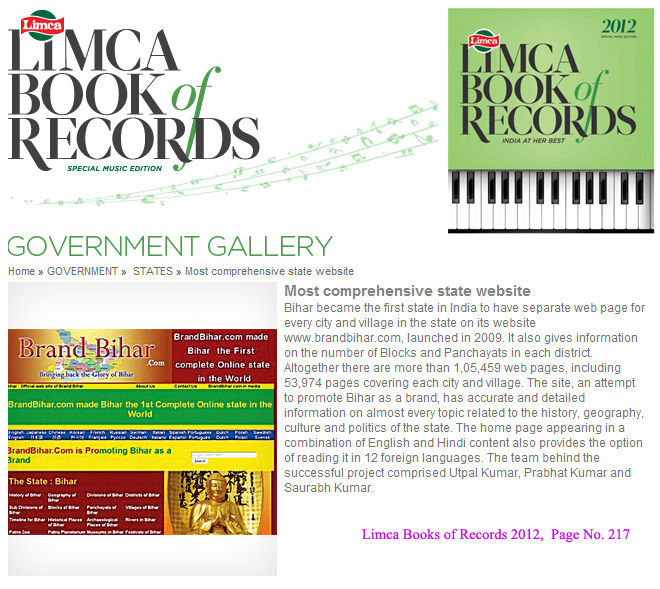
Bihar became the first state in India to have separate web page for every city and village in the state on its website www.brandbihar.com (Now www.brandbharat.com)
See the record in Limca Book of Records 2012 on Page No. 217